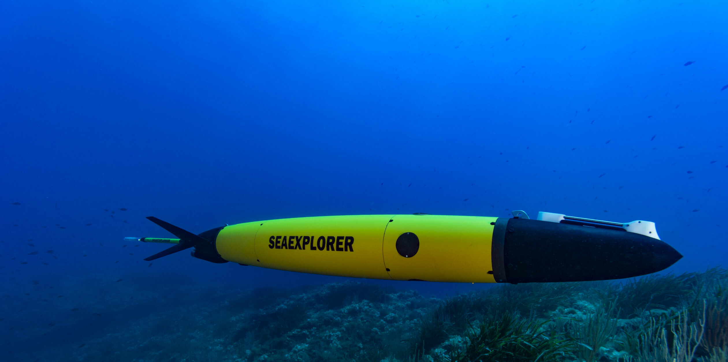
Developed in the 1980s and 1990s, underwater gliders were designed to be small, intelligent, mobile and affordable. At a time, ocean observation relied mainly on expensive and punctual expeditions using research vessels.
Decades later, autonomous underwater vehicles (AUV) have reached a mature stage. Now, research institutes and agencies routinely operate gliders. Typically, gliders profile from the surface to the seabed and back – a cycle that lasts between half an hour to six hours. Gliders travel at speeds around 0,5 knots even in extreme weather conditions. They can stay at sea for multiple months. In special cases, operators can deploy gliders for a year with survey tracks extending over thousands of miles.
Marine robots are now widely used for ocean observation, marine research, and increasingly by private companies. Their demand-led growth is on par with the rapid evolution of marine robotics and sensing technologies. More recently, autonomous surface vehicles (ASV) are beginning to boom and complement AUVs with surface measurements.
ASVs and AUVs are both included in the Marine Autonomous Systems (MAS) category. Interest in marine autonomous systems primarily resides in their various payloads. In particular, these payloads amount to multi-parameter sensors on gliders that measure a combination of these physical & chemical variables:
Physical variables :
- Pressure
- Temperature
- Salinity
- Currents
- Turbulence
- Wind speed
- Biological variables relevant to phytoplankton and zooplankton
Chemical variables :
- Dissolved oxygen
- Irradiance
- Carbon dioxide
- pH
- Nitrate
- Hydrocarbon
- Our Ocean’s Health is at stake
The ocean is of utmost importance in the earth’s ecosystem. Marine waters contain some of the most biologically diverse ecosystems on the planet. Oceans and seas are directly linked to global/regional climate, weather, ecosystems, living resources, and biodiversity. A healthy ocean is essential for our survival and wellbeing.
Three-quarters of the world’s mega-cities are by the sea, and 40% of the global population lives within 100 km of the coast. 90% of world trade is transported by sea and there is increasing development pressure in coastal waters for aquaculture, tourism, and renewable energy.
Physical and biogeochemical processes in the sea are not understood well enough. At the moment, data collected by conventional methods (i.e. ships & moorings) are scarcely distributed both in time and space and do not meet the basic requirements posed by these challenges.
- Ocean Observing Value Chain: A Need for Cooperation
Because the ocean observing value chain is not executed by multiple entities and organizations, its success relies on the coalescence of various subprocesses. Therefore, it is of critical importance that coordination activities are established. A coordinated research institute can facilitate the optimisation of their operation and thus further contribute to the ocean observing value chain. The glider community successfully launched OceanGliders, a program whose objective is to “monitor the global glider activity, share the requirements, efforts and scientific knowledge needed for glider data collection and support the dissemination of glider data in global databases, in real-time and delayed mode, for a wider community.”
- MAS’s Contributions to Science & Society
MAS can go places research vessels can’t access. They can observe under the ice and through storms. Hence, its data improves hurricane forecast and has led to major results in weather forecasting, climatology, and ocean state estimates. MAS can profile areas of the ocean research vessels cannot access. They can go under the ice and through storms. Data collected by MAS improve hurricane forecast and have led to major results in weather forecasting, climatology, and ocean state estimates.
Ocean observation data are also useful to a wide variety of stakeholders such as fisheries, pollution agencies, search and rescue, and industry. A wide range of services have already been developed and demonstrated. Although, they are not often used. GROOM Research Iinfrastructure (RI) addresses this issue and explores new applications for gliders. Lastly, the GROOM II Project consortium currently developing the RI takes into consideration developments in miniaturized sensor systems and artificial intelligence as well as emerging markets.
- Boundary currents
- Air-sea interactions during storms, hurricanes, typhoons
- Water transformation phenomena
Ocean observation data is also useful to a wide variety of stakeholders such as fisheries, pollution agencies, search and rescue, industry and so on. Services have already been developed and demonstrated. Yet, they are not often used. GROOM II addresses this issue and explores new applications of MAS. Lastly, the consortium takes into consideration developments in miniaturized sensor systems and artificial intelligence as well as emerging markets.
-
Protecting the Oceans through Improved Observation & Understanding Its Functions
Better understanding of physical, biogeochemical, and biological processes in the ocean improves our capacities to predict and address climate change challenges.
Gaining ocean knowledge follows these steps, including:
- Requirements setting process - why we observe;
- Scientific approach - how we observe;
- Adequacy of observational elements - what we observe with;
- Data flow and data integration - how we unlock the observational potential;
- Data product creation, dissemination and co-design with users - how we integrate and communicate.
While the outline of this chain is simple, the steps are complex to implement and execute. Having a complete and high quality data value chain is a crucial challenge. Marine autonomous systems are the best available tools that not only provide better time and space scales of observation but also implement greener solutions! GROOM RI is the network to make this happen.

